
Drive Green Transformation from Space Reduce GHG from the Ground
Creating value on the ground, informed by insights from space.
We analyse data from multiple satellite sources using AI on our proprietary platform, transforming it into actionable MRV insights.
Delivering visualised data across a wide range of sectors, supporting not only on-the-ground greenhouse gas (GHG) reduction and the creation of environmental value, but also informed business decision-making.
MRV: Measurement, Reporting and Verification — an end-to-end process encompassing measurement, analysis, reporting and verification.

VISION
MAKE EARTH VISIBLE
Making Change on Earth Visible
Accurate measurement and objective verification are increasingly essential across a wide range of activities, extending beyond climate action. From greenhouse gas (GHG) reduction management and carbon credits to disaster response and equipment condition monitoring. The ability to implement effective MRV is becoming a key factor in achieving meaningful results across industries.
Built around our platform, GBS leverages wide-area, high-frequency observation data collected by satellites and unmanned aerial vehicles (UAVs), such as drones, in Japan and around the world. We support corporate business decision-making across a broad range of sectors, including livestock, agriculture, forestry, fisheries and industry.
MISSION
MEASUREMENT. REDUCTION. CREATION.
Measure the Earth. Reduce GHG Emissions. Create Environmental Value.
GBS go beyond assessing area characteristics using satellite and other data. Working collaboratively with on-the-ground stakeholders, we validate and develop greenhouse gas (GHG) reduction methodologies. Through support for carbon credit development and related initiatives, we aim to establish economically self-sustaining models for GHG reduction and green transformation (GX).
-
2+α CORE SERVICES
Data solutions powered by our proprietary MRV platform and automated AI analysis, complemented by GHG reduction and carbon credit support, as well as integrated energy solutions.
-
20+ SATELLITES
With satellite constellations at the core, GBS combine a range of technologies, including microwave and optical sensors. We select the most suitable satellites and technologies for each application to deliver solutions tailored to our clients' needs.
-
~2050 TARGET
We develop medium-term initiatives aligned with the Japanese government's long-term carbon neutrality goals. Our measurement capabilities span a wide range of sectors and cover both Japan and other Asian markets.
WHAT WE AIM
What GBS Aims to Achieve
-
 01
MRV Platform & Data Solution
We analyse advanced satellite data on our platform and deliver insights to clients in a visualised and automated format. The platform also enables the verification of on-the-ground outcomes, supporting green transformation (GX) initiatives through MRV, as well as broader business decision-making. Beyond GX, our MRV platform can also be applied to a wide range of other fields where satellite data offers practical value.
-
 02
GX & Environmental Value Support
By leveraging our platform, we provide end-to-end support from methodology development and on-the-ground greenhouse gas (GHG) reduction initiatives to carbon credit generation and the integration of carbon neutrality into business management. Beyond GX, we also support the application of satellite data across other fields, from methodology development through to practical implementation.
-
 03
Energy independence
GBS has its roots in the energy sector. To support carbon neutrality, we plan and support locally tailored solutions that leverage renewable energy, energy storage, microgrids and emerging energy technologies. Through these initiatives, we help communities achieve greater energy independence and stimulate local revitalisation.
ISSUE
Using satellite data in the field is still a work in progress
Satellite-based measurement and monitoring, and on-the-ground activities such as greenhouse gas (GHG) reduction, each have their own established expertise. However, opportunities to bring these two fields together remain limited. GBS bridges this gap, aiming to deliver MRV solutions that provide objective evidence of the processes and outcomes of decarbonisation initiatives, carbon credit generation, and other industrial activities.
SAT. DATA PROVIDER
Satellite data providers
International organisations, satellite startups and other players are making high-quality satellite data increasingly available. Around the world, private companies are deploying thousands of new satellites each year, with low Earth orbit (LEO) satellite constellations playing a central role in this expansion. However, the use of satellite measurement data remains fragmented. Establishing industry-specific applications and practical ways to integrate these insights into on-the-ground operations remains an important challenge.
FIELD SERVICE PROVIDERS
Field servicers
Businesses specialising in GHG reduction consulting and carbon credit development bring strong expertise in on-the-ground operations. However, their knowledge of satellite data itself is often limited, and integrated capabilities that connect satellite and aerial measurements with ground-based measurements — and translate these insights into practical on-the-ground action — remain underdeveloped. Similarly, for companies looking to incorporate satellite data into their business operations, practical applications of this technology remain largely unexplored.
GREEN BRIDGE
A bridge built on the MRV platform
By understanding the specific data requirements of each sector, GBS ensures that appropriate measurements are carried out, while supporting the planning and implementation of on-the-ground initiatives and the development of viable business models to generate economic value from these activities. Leveraging its proprietary platform, GBS aims to deliver integrated data services as an MRV platform provider that bridges data and real-world operations.
CORE SERVICE 01
MRV PLATFORM / DATA SOLUTION
MRV Platform & Data Solutions
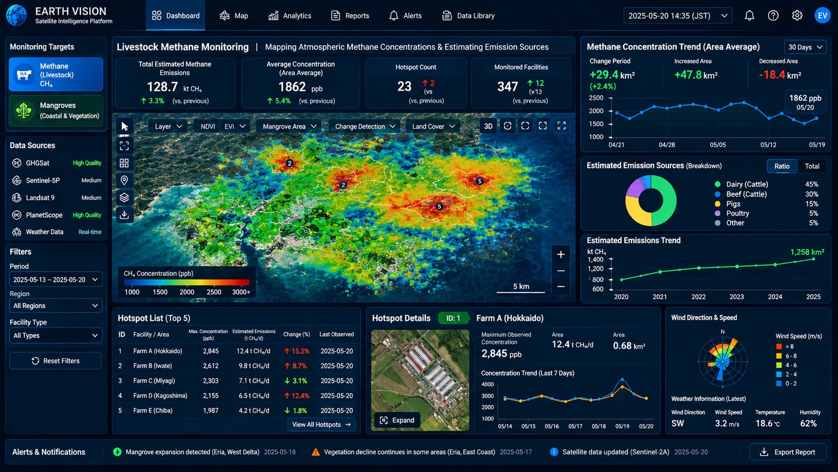
GBS brings satellite data from providers in Japan and around the world together, applying it across livestock farming, agriculture, forestry, marine environments, urban areas, infrastructure and climate monitoring.
We analyse and visualise the data to address each client's specific needs, delivering insights that support practical decision-making. Where appropriate, we also incorporate field measurements and other data sources.
-
01
Integrating Satellite and Other Data
We consolidate data from multiple sources, including low Earth orbit (LEO) satellites, in a centralised database. By considering the measurement method, target and client objectives, we build a dataset tailored to each use case.
-
02
Identifying Sources and Hotspots
GIS mapping of concentration patterns reveals where action is most needed across a wide area. We identify and prioritise hotspots, translating these insights into targeted on-the-ground measures. Satellite data provides the foundation for our analysis, complemented by aerial and drone-based measurements where necessary. Field measurements can also be incorporated to enhance the assessment.
-
03
Time-series monitoring
Continuous observation tracks how emissions change before and after an intervention, so the effect can be verified with objective figures at any time.
-
04
Reporting, GUI and API integration
Results are available on the dashboard, as exported reports, and through API integration with existing systems — something we roll into your decision-making process together with you.
CORE SERVICE 02
GX & ENVIRONMENTAL VALUE SUPPORT
GX & Environmental Value Support
We support the entire process of environmental value creation — from methodology development and measurement to on-the-ground GHG reduction, reporting, verification and carbon credit generation. Our integrated approach brings together activities that are often handled separately.
-
Satellite Observation
High-precision methane-monitoring satellites observe large areas and collect concentration data. We use these data to build a database of methane concentration patterns.
-
Clustering
Based on the measurements, nearby farms are grouped into clusters to efficiently identify emission sources and establish baseline concentration levels across a region. This helps identify areas where GHG reduction efforts should be prioritised.
-
Concentration Mapping
The identified areas are visualised in Earth Vision GIS, showing emission levels by cluster and highlighting where targeted mitigation measures are most needed.
-
Fixed-Point Measurement
Guided by the analysis in Earth Vision, ground-based measurements are taken at selected locations. Where useful, these are supplemented by low-altitude measurements using drones or other unmanned aerial vehicles (UAVs) to identify hotspots with the highest GHG concentrations.
-
Implementation of GHG Reductions
At identified hotspots, ground sensors, wind gauges, communications equipment and data systems are installed for continuous monitoring. Targeted GHG reduction measures, such as manure treatment, changes in animal feed and conversion to biofuel, are then implemented.
-
Carbon Credit Generation
The achieved GHG reductions are quantified using measurement data and recognised methodologies. Once the reductions have been verified and certified by the relevant body, they can be issued as carbon credits. We support clients in registering and bringing these credits to domestic and international carbon markets.
Starting with environmental monitoring and livestock, coverage will expand through agriculture such as paddy fields, forestry and brackish-water vegetation, and on to industrial and other applications.
CORE SERVICE 03
ENERGY INDEPENDENCE
Regional Energy Independence Services

Building on GBS's energy-sector expertise, we work with local authorities to plan clean, reliable energy systems that strengthen disaster resilience while exploring next-generation energy solutions. Through our global energy-sector network, we support projects from demonstration through to implementation.
CONSULTING
More Than Data
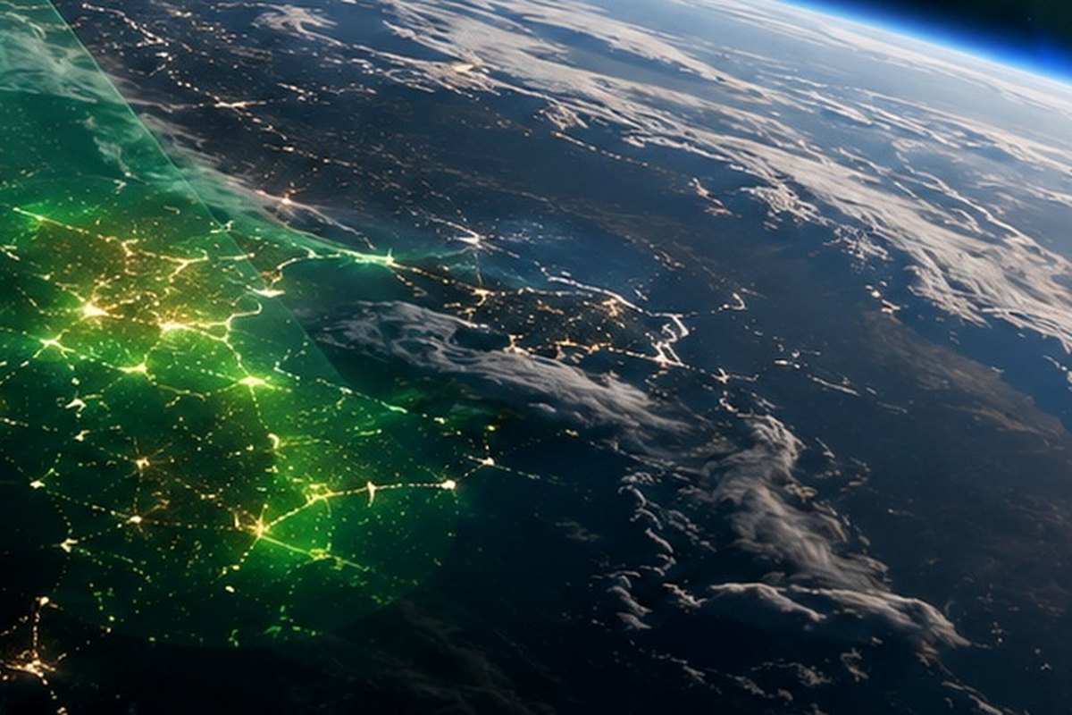
GBS goes beyond supplying satellite data.
We help clients put data into practice, supporting them from GX strategy and decarbonisation management to J-Credit projects and public funding applications.

DOMAINS
Fields of Application
As satellite measurement capabilities continue to expand, we are progressively broadening the industries and sensor types we cover, with the goal of building an environmental data platform for a wide range of sectors.
-
AGRICULTURE
Agriculture
Crop health, soil moisture, fertiliser optimisation, methane emissions from rice paddies and soil carbon management.
NDVI / EVI / Hyperspectral
-
LIVESTOCK
Livestock
Cluster-level measurement of methane emissions from livestock farms and verification of emissions-reduction measures.
Methane detection (GHGSat)
-
FORESTRY
Forestry
Forest area and biomass estimation, carbon sequestration assessment and monitoring for potential illegal logging.
Optical / SAR
-
OCEAN
Ocean
Mangrove extent, sea surface temperature, chlorophyll-a and monitoring of aquaculture environments.
Ocean colour / Infrared
-
INFRASTRUCTURE
Infrastructure
Urban heat, ground displacement and changes in infrastructure over time.
SAR
-
ENERGY
Energy
Leak detection at industrial facilities, site selection for renewable energy and baseline data for energy supply-demand forecasting.
Methane detection / Optical
-
DISASTER RESPONSE
Disaster
Damage assessment, flood mapping and ongoing monitoring of recovery.
SAR / Optical
-
CLIMATE
Climate
Continuous, wide-area monitoring of climate indicators such as precipitation, salinity and sea surface height.
Microwave / Rain radar

NEWS
VIEW ALLNo news at the moment.

CONTACT
Put Satellite Data to Work for Your Business
Contact us to discuss satellite data applications, GX and decarbonisation management, J-Credit projects or public funding.
Our specialists will recommend an approach tailored to your needs.